
Vodafone
59% of the route with any signal
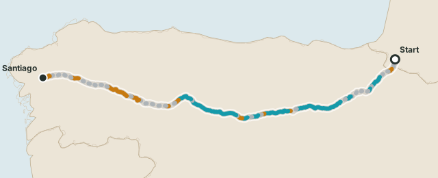
- 4G / 5G
- 41%
- 2G / 3G
- 18%
- No signal
- 41%
Walking the Camino? Driving Iceland's Ring Road? TrailSim compares carrier coverage along your exact route and tells you which eSIM keeps you connected — and on every analysed route, an offline map of its dead zones comes free with your order.
Plans from under $5, one-time purchase · Secure Stripe checkout · QR code in minutes · 14-day refund before installation

 Camino FrancésFrance · Spain
 Ring RoadIceland
 Route 66United States
Browse all 84 routes
Route 66United States
Browse all 84 routes
61 routes analysed · 47,448 km of trail and road checked · 1,018 dead zones mapped
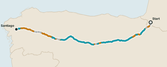
A real-world modeled comparison along the 768 km Camino de Santiago. Both maps show the exact same route at the same scale, so you can see where each carrier becomes weak or disappears completely.
59% of the route with any signal
86% of the route with any signal
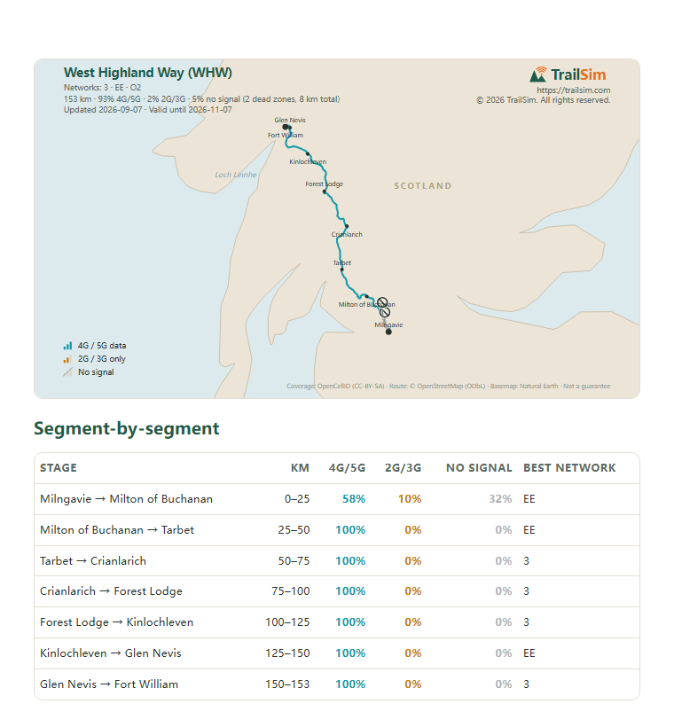
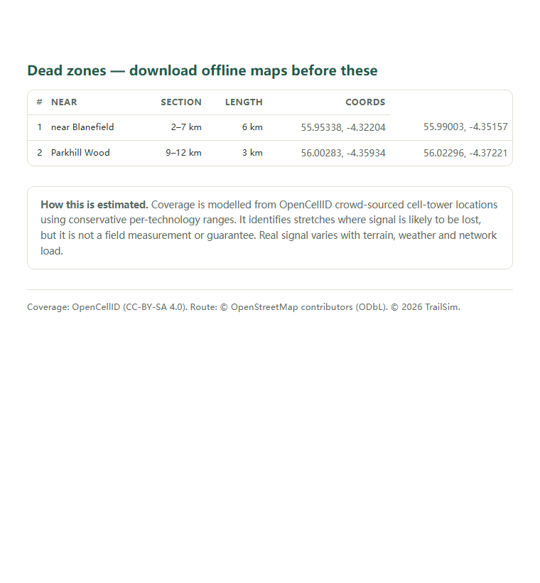
Every analysed route's order includes its coverage report — these pages are the real one for the West Highland Way (WHW). On the trail there is no signal, so it is a PDF you keep on your phone or print, plus a GPX track that puts every dead zone on your map app as you walk.
Included free with every plan on analysed routes, emailed within minutes of purchase.
TrailSim is independently built and run by one developer — James Moore, a long-distance hiker who wanted honest signal data for trails. Payments are processed by Stripe and appear on your card statement as TRAILSIM, and refunds are self-service within 14 days for uninstalled eSIMs. More on the about page.
From public signal data, chosen per route: crowd-sourced cell-tower locations (OpenCellID), US carrier propagation filings from the FCC National Broadband Map, Ofcom's drive-test measurements on some UK roads (Lake District, North Coast 500), and carrier transmitter licences from Australia's ACMA register — mapped onto OpenStreetMap route geometry and sampled every 500 meters for each carrier. Every report states its own source and that it is an estimate, not a guarantee. See how it works.
Most phones released since 2019 support eSIM, including iPhone XS and later, Google Pixel 3 and later, and most recent Samsung Galaxy models. Your phone must also be carrier-unlocked.
A GPX and PDF map of your route with signal, weak-signal and no-signal sections marked. It works fully offline in apps like Gaia GPS, Komoot or Organic Maps.
Public network data, modelled along your exact route — with the eSIM that keeps you connected.
Check my route coverage